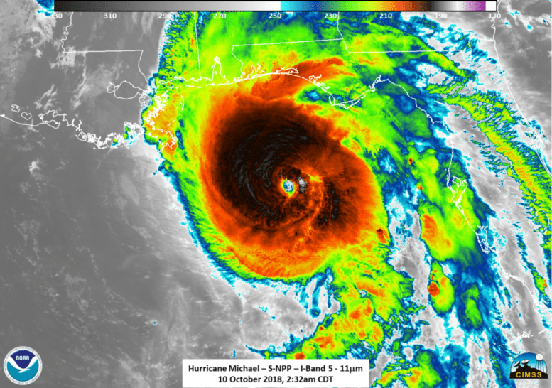
Hurricane Michael continued to intensify as it made landfall off the coast of Panama City, Fla.
FIU meteorologist Haiyan Jiang explains that nearly every storm experiences a period of rapid intensification — when maximum sustained winds increase at least 35 mph in 24 hours or less. However, Michael has had three such periods in three days, going from tropical depression to a major category 4 hurricane.
“This is definitely not normal,” Jiang said. “The environment has been somewhat favorable, but not consistently favorable. Although the sea surface temperature in the Gulf has been warmer than the average, the shear was high initially which led to a gradual, instead of rapid, intensification forecast by the National Hurricane Center until the shear decreased Monday morning.”
The problem is that rapid intensification is unpredictable. With her research, Jiang hopes to change that.
Using passive microwave satellite observations, Jiang has developed an algorithm that can help predict the onset of rapid intensification of major storms. Forecasters at the National Hurricane Center and the Navy’s Joint Typhoon Warning Center are now using her data throughout the hurricane and typhoon seasons to improve storm modeling.
The National Hurricane Center first began monitoring Michael on Oct. 2. when it was just a disturbance in the southwestern Caribbean Sea. It has since had seven 24-hour rapid intensification periods. With the aid of satellite images and statistical rapid intensification prediction models, the National Hurricane Center was only able to predict the last intensification period.
According to Jiang, the intensification that took Michael from a category 2 to a category 4 overnight is still ongoing and may continue until landfall.


